Quick Take
- Narration: Joel Richards delivers a competent reading that mirrors the book’s tone, like a knowledgeable friend talking you through something he finds genuinely fascinating.
- Themes: Ancient cartography, lost civilizations, the limits of mainstream archaeology
- Mood: Methodical and speculative, with genuine intellectual energy in the better sections
- Verdict: A cult classic of alternative archaeology that rewards listeners willing to engage with the argument on its own terms, though the audio format loses the maps entirely.
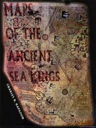
Maps of the Ancient Sea Kings is one of those books that has never quite gone away, despite being first published in 1966 and sitting comfortably in the territory that professional archaeologists tend to classify as fringe. Charles Hapgood was a historian at Keene State College in New Hampshire, and his central thesis, that certain medieval and Renaissance portolan charts preserve cartographic knowledge from a much earlier and technically sophisticated civilization, generated serious attention when it first appeared. Albert Einstein wrote a foreword to an earlier Hapgood work. That does not make the argument correct, but it does suggest the quality of the questions being asked.
Joel Richards narrates this 1996 audio edition, and a reviewer described his delivery as similar to talking with a very knowledgeable and interesting friend, which is exactly right. Richards does not perform the material. He presents it, with the kind of enthusiasm that comes from someone who clearly finds the subject worth taking seriously. For a book built on the sustained examination of historical documents and cartographic anomalies, that conversational quality matters more than it might in a more narrative-driven work.
Our Take on Maps of the Ancient Sea Kings
Hapgood’s most famous exhibit is the Piri Reis map of 1513, which appears to show a geographically accurate representation of the Antarctic coastline, including features that would have been covered by ice for millennia by the time the map was drawn. His argument is that the map was compiled from earlier source maps of unknown origin, and that those source maps reflect a level of cartographic and navigational precision far beyond what any known ancient civilization is credited with achieving.
The implication, which Hapgood explores with scholarly caution rather than sensational certainty, is that a sophisticated maritime civilization existed in deep prehistory and left traces in the form of maps that were later copied, fragmented, and preserved through the ancient libraries of Alexandria and elsewhere. The question he raises about those Alexandria library fragments, described in a reviewer’s note as a way to lead from twilight into darkness, is one of the book’s more haunting formulations.
Why Listen to Maps of the Ancient Sea Kings
For listeners drawn to the intersection of archaeology, cartography, and the history of exploration, this book offers a genuine intellectual experience, regardless of where you ultimately land on the central argument. Hapgood proceeds empirically, examining specific maps with the help of collaborators including students at Springfield College, and his methodology is more rigorous than most alternative history writing.
The material also illuminates the mainstream history of exploration in useful ways. Columbus’s use of earlier maps, the Norwegian voyages, the question of what navigational knowledge was available to medieval sailors: these are genuine historical puzzles, and Hapgood’s frame brings a different kind of attention to them.
What to Watch For in Maps of the Ancient Sea Kings
The central limitation of the audio format for this particular book is significant: the maps themselves, which are the actual evidence for Hapgood’s argument, are visual documents. A reviewer noting that the 1996 paperback is black-and-white rather than color is pointing at a real problem that the audio format makes total. You are listening to detailed descriptions of cartographic features without being able to see them. Listeners who want the full experience of Hapgood’s argument should have a copy of the maps available separately, whether through the print edition or online sources.
The 3.7 rating across only nine reviews reflects a small and divided sample. It is not a meaningful quality signal for a book this old and niche.
Who Should Listen to Maps of the Ancient Sea Kings
Listeners curious about alternative archaeology and the history of cartography who are willing to engage with Hapgood’s argument on its own evidential terms will find this rewarding. Those expecting the book to be debunked throughout or to provide mainstream archaeological consensus will find it frustrating in the other direction. Pair the audio with access to the actual maps for the fullest experience.
Frequently Asked Questions
Is Maps of the Ancient Sea Kings considered credible by mainstream archaeology?
The book is generally classified as alternative or fringe archaeology by mainstream scholars, who challenge Hapgood’s interpretation of the Piri Reis map and his assumptions about prehistoric civilization. However, the questions he raises about the source maps used by medieval cartographers are genuinely interesting historical puzzles, and the book is taken seriously by readers interested in the history and limits of established knowledge.
Can I follow the argument without seeing the actual maps?
With difficulty. The audio format is a real limitation here because Hapgood’s entire case rests on the visual evidence of the maps themselves. Richards describes them in sufficient detail to follow the logic, but listeners who want to evaluate the argument independently should have the maps available from the print edition or online sources.
What is the Piri Reis map and why is it central to the book?
The Piri Reis map is a 1513 Ottoman map that appears to show the Antarctic coastline with surprising accuracy, despite Antarctica not being officially discovered until 1820. Hapgood argues the map was compiled from much older source maps reflecting advanced ancient cartographic knowledge. It is his most famous piece of evidence and the anchor of the book’s central thesis.
How does Joel Richards’ narration suit a book built on detailed cartographic analysis?
Richards takes a conversational approach that one reviewer compared to a knowledgeable friend walking you through something fascinating. For material this dependent on following a methodical argument rather than a narrative, that register works well. He does not oversimplify or dramatize, which is the right call.